
It has been all go in the Marble Arch Caves UNESCO Global Geopark! As a project partner of the EU funded Drifting Apart, Geopark staff have been kept busy delivery some of the exciting outputs of this innovative project.
Geopark staff have been out and about with Geopark Geologists Kirstin (from Geological Survey of N. Ireland) and Sarah (from Geological Survey of Ireland) choosing the most interesting geological sites in the Geopark which do not have public access.
These chosen sites are disused quarries which display some significant geological features, such as the stunning Garrison Sill seen in the photos below (yes, Fermanagh skies are always that blue…!). This very rare outcrop of the sill is exposed in a former quarry that was worked for “whinstone”. It displays exceptional exposures of both Carboniferous Limestone into which the Garrison Sill has been intruded, and of the sill itself. This feature originates from the Palaeogene period (about 60 Ma) when North America was pulling away from Europe. The aim is to provide access and interpretation to these sites by a virtual means, creating a number of 3D “virtual Geopark sites” which will be available to the public and utilisied for educational purposes.
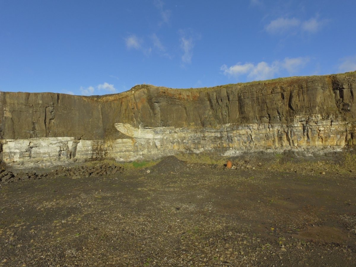
Photo: Garrison Sill in Marble Arch Caves UNESCO Global Geopark
Staff are currently developing a Geopark site to create public access and provide interpretation of the intricate landscape of Gortmaconnell Townland, such as explaining the significance of the Cuilcagh Dyke, reef knolls and the disappearing Owenbrean River, as well as how the geology here links with that of our partners in Northern Ireland, Scotland, Norway, Canada, Russia and Iceland!

Photo: Cuilcagh dyke on Gortmaconnell townland in Marble Arch Caves UNESCO Global Geopark